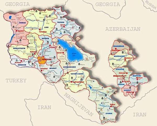
| GEOGRAPHICAL INFORMATION
Territory: 29.74 thousand
square km
Average elevation above sea
level : 1800 m.
The highest peak: Aragats
mountain - 4090 m.
The lowest altitude: Debed
river canyon - 380 m.
The greatest extent: 365 km.
Region: north latitudes of
subtropics.
Climate: dry, continental.
Average temperature: in January
-6.8oC,
in July +20.8oC.
Time zone: Greenwich mean
time + 4 hours.
Previous
| HOME | Next |